


 the_thames_path_main.jpg
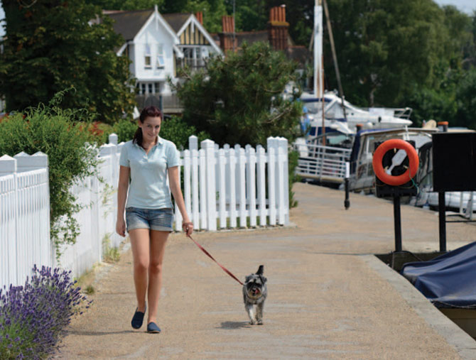
Your Dog Magazine sampled part of the Thames Path accompanied by Emily Woods and her Miniature Schnauzer, Daisy, who travelled from Barnstone, Nottinghamshire.


We walked from Marlow to Cookham, then returned to Marlow by train...
The Thames Path National Trail
The Thames Path meanders 184 miles as it follows the river from its source in the Cotswolds, all the way through the heart of London to the Thames Barrier in Greenwich. The trail combines a mixture of delightful scenery with many historical landmarks as the largest river in England evolves. Sampling any part of the route gives walkers the chance to share the river’s stories and take a look at the various riverside communities.
The section from Marlow to Cookham is a designated route on the National Trails website, where visitors can download a map of the walk. It was recommended by Elaine Townson, information and administrative officer for the Thames Path.
“I’d recommend this walk for a number of reasons,” said Elaine. “Firstly, this stretch goes through arguably the most beautiful part of the Thames Valley. It starts in the lovely town of Marlow with its suspension bridge, then the Chiltern Hills dominate the views all the way to Cookham, which is really picturesque.
“It is also easy walking and not too long. It should take just over two hours to complete. There’s plenty to see along the river, from bustling towns to quieter countryside.”
For more information on National Trails, including the Thames Path, visit www.nationaltrail.co.uk
The walk
1. From the train station, walk down Station Road and turn left on to High Street. Head down towards the river where you can view the Marlow suspension bridge. Take the footpath from High Street in front of the All Saints Church. The path cuts through St Peter Street and brings you out on Mill Road.
Turn right and follow the road as it turns on to Gossmore Lane. Immediately enter Pergola Field on the right, signposted for the Thames Path.
2. Walking through Pergola Field, join the river bank. There are dog bins located on the path. Exit the field past the football pitches on Gossmore Recreation Ground on your left and head under the A404 bridge. It is possible to park at the recreation ground and join the path at this point if you have travelled to Marlow by car.
3. The path sweeps round to the left through fields. Beware, livestock are kept in the fields and although the path is fenced off it is a good idea to keep your dog on the lead. Daisy was only interested in taking her first dip in the water. She enjoyed cooling off but for a longer play there are better spots further downstream.
4. Through the gate the path widens as you enter Riverwoods. Dogs will enjoy being let off the lead and exploring in the trees. The trees on the bank begin to thin here, so take a look at some of the stunning buildings that line the route on the opposite bank.
5. Emerging from the woodland there is a long stretch of fields. Warning signs tell you to keep dogs under control as there might be cattle. The fields are sectioned off, so Daisy was off the lead until we entered a field containing cattle. If you have any concerns, keep your dog on the lead. There are also some mini beaches where the bank has fallen away, making it easy and safe to enter the water. Daisy dived straight in and Emily went for a paddle too.
6. From the tranquility of the fields you enter the community of Bourne End via Riverside Road. Daisy was put on the lead as we passed through the Upper Thames Sailing Club into the busy riverside community.
If you feel you have walked far enough you can leave the route via Wharf Lane. Bourne End train station lies just a couple of minutes from the path with trains heading back to Marlow.

7. Follow the Thames Path signposts down a narrow path towards the bridge. Take the bridge to the opposite side of the river. The steps are quite steep so older or smaller dogs might need help. The route is signposted as it continues on the opposite bank. With Daisy and Emily ready for a break, we walked back upstream a few hundred yards to a pub called The Bounty.
8. Rejoining the trail takes you into Cock Marsh, a lowland reserve full of interesting wildlife and plants. There are also some Bronze Age burial mounds. If you want to take a closer look there is a circular route round Cock Marsh which rejoins the trail.
Cattle can graze in the field so Daisy remained on her lead as a precaution. Near the exit to the marsh is another small bay which is a great spot to get into the water — it was busy with lots of dogs having a swim.
9. Leaving Cock Marsh, enter a meadow. Here there was lots of space so Emily let Daisy have a run around off the lead.
The path forks about halfway through the field. The suggested route goes to the left and will take you through the village of Cookham. To take a short cut, walk straight on through the field to the car park on the main road.
10. Take the trail through the sailing club and into the park. Take one last look down the Thames as you leave the riverside and follow the signs for the path inland.
The path runs through a picturesque churchyard. Turn left out of the churchyard and follow the main road round to the right, directly on to High Street.
11. Stay on High Street as you walk through The Pound National Trust conservation area. If you have taken the short cut this is where you will rejoin the walk. Follow the road a few hundred yards and the entrance to Cookham train station is located on your left.
Trains run to Marlow every hour and cost £3.10 for a single, as long as you are travelling after 9am. Dogs are allowed on the service, as long as they remain on the lead and do not take up a seat. The journey takes around 16 minutes.
Some services will require you to change trains at Bourne End. Looking out the window will give a nice review of where you have just walked as much of the track runs alongside the Thames Path.
Marlow and the local area
Marlow is an elegant town with lots always happening on the river. In Higginson Park you can see a statue of the town’s most famous son, Olympic rower Sir Steve Redgrave. There is a small selection of dog-friendly pubs, including The Two Brewers which is conveniently situated on the route in St Peter Street.
It allows dogs in the bar and the garden. A little further out of town there is also the Hare and Hounds and The Royal Oak. For those looking for a longer stay, the Macdonald Compleat Angler is a luxury hotel situated on the banks of the Thames overlooking the Marlow suspension bridge. It allows dogs at a charge of £10 per night.
The Bounty pub is just off the trail near Cock Marsh with a great view of the river. It is incredibly welcoming to dogs and owners. There is a doggy menu, dog chews in exchange for a donation to charity, and dog water bowls. We sat outside to eat, although dogs are welcomed inside too. Chatting to fellow customers confirmed this was one of the most popular pubs with dog owners in the area — it’s well worth a visit.
Cookham is a charming village said to have provided the inspiration for the novel ‘The Wind in the Willows’. Author Kenneth Grahame lived in Cookham for many years.
The Stanley Spencer Gallery lies on the route as does his birthplace. On the trail there are lots of pubs including The Kings Arms, which permits dogs in the bar area, and The Crown, which allows dogs in one side of the pub.
Walk facts
How to get there: Marlow is situated just off the A404, which connects the M40 and M4.
Terrain: Well-maintained footpaths with very few inclines. Some paths through fields might be difficult when wet.
Distance: 5½ miles.
Time: Two hours and 15 minutes.
Off-lead opportunities: Many, but control dogs near livestock.
Parking: There is no parking at Marlow station but there are lots of car parks in the town.
Toilets: Public toilets at Marlow and Cookham. The Bounty Pub en route is happy for walkers to use their toilets too.
Suitable for: Most walkers, although the steep steps of the bridge to Cock Marsh could prove difficult for those with mobility problems.